Supermarket nearby Netto
Denmark
Supermarket nearby Netto
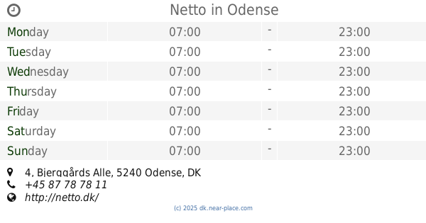
Netto
8, Strandvejen, 5800, Nyborg, DK Dinamarca
contacts phone
:
+45 87 78 78 11
website:
netto.dk
Latitude:
55.3099226
, Longitude:
10.7890625
larger map & directions
read more
nearest Supermarket
138 m
Kvickly Nyborg
Dronningensvej 1, Nyborg
Supermarket
read more
372 m
fakta Nyborg
Baggersgade 6-8, Nyborg
Supermarket
read more
372 m
Fakta
Baggersgade 6-8, Nyborg
Supermarket
read more
646 m
REMA 1000
Svaneparken 2, Nyborg
Supermarket
read more
768 m
Føtex Nyborg
Vestergade 28, Nyborg
Supermarket
read more
856 m
REMA 1000
Frisengårdsvej 19, Nyborg
Supermarket
read more
1.099 km
ALDI Nyborg
Vestergade 35B, Nyborg
Supermarket
read more
1.099 km
ALDI
Vestergade 35B, Nyborg
Supermarket
read more
1.124 km
LIDL
Storebæltsvej 5, Nyborg
Supermarket
read more
1.141 km
MENY Nyborg
Bøjdenvej 3-5, Nyborg
Supermarket
read more
1.56 km
SPAR Nyborg
Frisengårdsvej 91, Nyborg
Supermarket
read more
2.328 km
Fakta
Skaboeshusevej 103, Nyborg
Supermarket
read more
9.428 km
Netto
Nyborgvej 15-17, Ullerslev
Supermarket
read more
9.518 km
Dagli'Brugsen Ullerslev
Lundsager 10, Ullerslev
Supermarket
read more
9.542 km
Coop Dagli´Brugsen Ullerslev
Lundsager 10, Ullerslev
Supermarket
read more
9.575 km
SuperBrugsen
Hovedgaden 21, Ørbæk
Supermarket
read more
9.597 km
SPAR Ullerslev
Ullerslev-Centret 30, Ullerslev
Supermarket
read more
9.608 km
Netto
Hovedgaden 23, Ørbæk
Supermarket
read more
13.749 km
SuperBrugsen
Langeskov Centret 2, Langeskov
Supermarket
read more
13.967 km
REMA 1000
Grønvangen 3, Langeskov
Supermarket
read more
14.034 km
Netto
Grønvangen 1, Langeskov
Supermarket
read more
14.981 km
SPAR Rynkeby
Rynkeby Bygade 56, Rynkeby
Supermarket
read more
24.711 km
Danish Supermarked A / S
Bjerggårds Alle 4, Odense NØ
Supermarket
read more
24.72 km
Netto
Bjerggårds Alle 4, Odense NØ
Supermarket
read more
27.774 km
SPAR Stige
Stigevej 275, Odense N
Supermarket
read more
📑
all categories
Accounting
Administrative area level 1
Administrative area level 2
Airport
Amusement park
Aquarium
Art gallery
Atm
Bakery
Bank
Bar
Beauty salon
Bicycle store
Book store
Bowling alley
Bus station
Cafe
Campground
Car dealer
Car rental
Car repair
Car wash
Casino
Cemetery
Church
City hall
Clothing store
Colloquial area
Convenience store
Country
Courthouse
Dentist
Department store
Doctor
Electrician
Electronics store
Embassy
Finance
Fire station
Florist
Food
Funeral home
Furniture store
Gas station
General contractor
Grocery or supermarket
Gym
Hair care
Hardware store
Health
Hindu Temple
Home goods store
Hospital
Insurance agency
Jewelry store
Laundry
Lawyer
Library
Light rail station
Liquor store
Local government office
Locality
Locksmith
Lodging
Meal delivery
Meal takeaway
Mosque
Movie rental
Movie theater
Moving company
Museum
Natural feature
Neighborhood
Night club
Painter
Park
Parking
Pet store
Pharmacy
Physiotherapist
Place of worship
Plumber
Point of interest
Police
Political
Post office
Premise
Real estate agency
Restaurant
Roofing contractor
Route
Rv park, camping
School
Shoe store
Shopping mall
Spa
Stadium
Storage
Store
Subpremise
Subway station
Supermarket
Synagogue
Taxi stand
Train station
Transit station
Travel agency
University
Veterinary care
Zoo
sublocality level 1
sublocality level 2
↑