places in Hjortshøj
Denmark
Hjortshøj
Hjortshøj
Administrative Region:
Central
population:
3 714
calling code:
+45-xx xx xx xx
postcode:
8530
Location on the map of Denmark
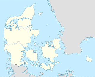
Hjortshøj
Restaurant
Sam's Pizza & Grillbar
Bøggildsvej 4, Hjortshøj
Restaurant
read more
Car repair
Hårup Dækservice
Balshøje 1, Hjortshøj
Car repair
read more
Bus station
Mejlbyvej/Sastrupvej (Aarhus Kom)
Denmark
Bus station
read more
Hindbærhaven/Asmusgårdsvej (Aarhus Kom)
Denmark
Bus station
read more
Brombærhaven/Asmusgårdsvej (Aarhus Kom)
Denmark
Bus station
read more
Hårup Skole/Mejlbyvej (Aarhus Kom)
Denmark
Bus station
read more
Hjortshøj/Hjortshøjvangen (Aarhus Kom)
Denmark
Bus station
read more
Hjortshøj Station
Denmark
Bus station
read more
Asmusgårdsvej/Hindbærhaven. Lystrup (Aarhus)
Denmark
Bus station
read more
Skæring Kirkevej/Skæring Hedevej (Aarhus Kom)
Denmark
Bus station
read more
Mejlbyvej/Delfivej v. Hårup Skole (Aarhus)
Denmark
Bus station
read more
Lystrup/Majsmarken (Aarhus Kom)
Denmark
Bus station
read more
Asmusgårdsvej/Brombærhaven. Lystrup (Aarhus)
Denmark
Bus station
read more
Skæring Hedevej/Skæring Parkvej (Aarhus)
Denmark
Bus station
read more
Smedebakken v. Gl. Hjortshøj Kirke (Aarhus)
Denmark
Bus station
read more
Skæring Parkvej/Skæring Hedevej (Aarhus Kom)
Denmark
Bus station
read more
Lokalcentret/Hjortshøj Stationsvej (Aarhus Kom)
Denmark
Bus station
read more
Furniture store
Den Gule Gård
Gammelvej 1, Hjortshøj
Furniture store
read more
Library
Hjortshøj Bibliotek
Virupvej 75, Hjortshøj
Library
read more
📑
Hjortshøj all categories
Bakery
Bus station
Car repair
Church
Clothing store
Electrician
Florist
Food
Furniture store
General contractor
Hair care
Health
Library
Liquor store
Local government office
Locality
Lodging
Meal delivery
Natural feature
Neighborhood
Painter
Park
Physiotherapist
Plumber
Point of interest
Premise
Restaurant
Roofing contractor
School
Shoe store
Store
Supermarket
Train station
↑