places in Hjorring
Denmark
Hjorring
Hjorring
Administrative Region:
North
population:
25 780
calling code:
+45-xx xx xx xx
postcode:
9800
Location on the map of Denmark
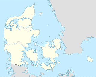
Hjorring
Roofing contractor
Carpenter Anders Bisgaard
Muhlesvej 19, Hjørring
Roofing contractor
read more
Carpenter Thomas Sorensen
Ths Smeds Vej 19, Hjørring
Roofing contractor
read more
Taars Tagdækning ApS
Hirtshalsvej 261, Hjørring
Roofing contractor
read more
Tømrermester Anders Bisgaard
Muhlesvej 19, Hjørring
Roofing contractor
read more
Tømrermester Thomas Sørensen
Ths Smeds Vej 19, Hjørring
Roofing contractor
read more
Beauty salon
CLUBTAN Sol & Wellness
Nørrebro 34, Hjørring
Beauty salon
read more
Annemettes Hud-og Fodpleje
Skjoldborgsvej 26, Hjørring
Beauty salon
read more
B-Beautiful
Strømgade 4B, Hjørring
Beauty salon
read more
B-Beautiful, v. Dorthe Brogaard
Strømgade 4B, Hjørring
Beauty salon
read more
Black and White Nails Spa
Søndergade 3, Hjørring
Beauty salon
read more
BY|SAHL
Bispensgade 35, Hjørring
Beauty salon
read more
Hårshoppen
Skælrodvej 3, Hjørring
Beauty salon
read more
New nails lb Denmark
Østergade 30, Hjørring
Beauty salon
read more
City hall
Det gamle rådhus i Hjørring.
Torvet 6, Hjørring
City hall
read more
Bymiljø Hjørring/Walk through Hjørring
Torvet 6, Hjørring
City hall
read more
Bymiljø Hjørring/Spazier durch Hjørring
Torvet 6, Hjørring
City hall
read more
Night club
Bo Ludvigsen
Højenevej 8, Hjørring
Night club
read more
Diskotek Confession
Jernbanegade 24B, 1 sal, 9800, Hjørring
Night club
read more
Parking
Trianglen parkeringsplads
Trianglen, P. Plads, Hjørring
Parking
read more
Mammutpladsen
Mammutpladsen, Hjørring
Parking
read more
Hjørring Station
Dronningensgade 30, Hjørring
Parking
read more
ONEPARK A/S
Østergade 53-55, Hjørring
Parking
read more
Østergade 53-55 Parking
Langelandsgade 6A, Hjørring
Parking
read more
Sct. Olai Plads
Sct Olai Plads, Hjørring
Parking
read more
📑
Hjorring all categories
Accounting
Administrative area level 2
Airport
Amusement park
Art gallery
Atm
Bakery
Bank
Bar
Beauty salon
Bicycle store
Book store
Bowling alley
Bus station
Cafe
Campground
Car dealer
Car rental
Car repair
Car wash
Cemetery
Church
City hall
Clothing store
Convenience store
Courthouse
Dentist
Doctor
Electrician
Electronics store
Finance
Fire station
Florist
Food
Funeral home
Furniture store
Gas station
General contractor
Grocery or supermarket
Gym
Hair care
Hardware store
Health
Home goods store
Hospital
Insurance agency
Jewelry store
Laundry
Lawyer
Library
Liquor store
Local government office
Locality
Locksmith
Lodging
Meal delivery
Meal takeaway
Mosque
Movie theater
Moving company
Museum
Natural feature
Neighborhood
Night club
Painter
Park
Parking
Pet store
Pharmacy
Physiotherapist
Place of worship
Plumber
Point of interest
Post office
Premise
Real estate agency
Restaurant
Roofing contractor
Route
School
Shoe store
Shopping mall
Spa
Stadium
Storage
Store
Subpremise
Supermarket
Train station
Travel agency
University
Veterinary care
sublocality level 1
↑