places in Herlufmagle
Denmark
Herlufmagle
Herlufmagle
Administrative Region:
Zealand
population:
1 456
calling code:
+45-xx xx xx xx
postcode:
4160
Location on the map of Denmark
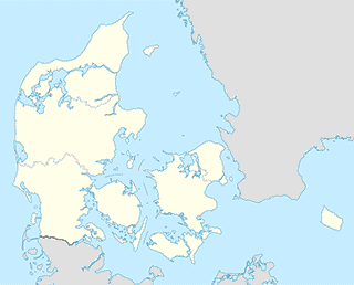
Herlufmagle
Administrative area level 2
Næstved
Danmark
Administrative area level 2
read more
Næstved
Dinamarca
Administrative area level 2
read more
Campground
Nåby Camping - Æblehaven - Kanoudlejning - Næstved
Nåbyvej 8, Herlufmagle
Campground
read more
Real estate agency
Aj Service v/Allan Jensen
Broksøvej 12, Herlufmagle
Real estate agency
read more
Subpremise
Red Cross Op Shop
Vandværksvej 32 Gelsted, Herlufmagle
Subpremise
read more
Røde Kors tøjcontainer
Vandværksvej 32 Gelsted, Herlufmagle
Subpremise
read more
Røde Kors tøjcontainer
Håndværkervej 24, Herlufmagle
Subpremise
read more
Red Cross Op Shop
Håndværkervej 24, Herlufmagle
Subpremise
read more
Bus station
Stien, Næstvedvej (Næstvedvej)
Denmark
Bus station
read more
Vink - Bækgårdsvej (Næstvedvej)
Denmark
Bus station
read more
Egevej (Stenskovvej)
Denmark
Bus station
read more
Egevej (Platanvej)
Denmark
Bus station
read more
Lindevej (Stenskovvej)
Denmark
Bus station
read more
Platanvej (Næstvedvej)
Denmark
Bus station
read more
Platanvej v Akacievej (Platanvej)
Denmark
Bus station
read more
Næstved Fri Skole (Havrebjergvej)
Denmark
Bus station
read more
Bækgårdsvej (Næstvedvej)
Denmark
Bus station
read more
Gerdrupvej (Sorøvej)
Denmark
Bus station
read more
Vink - Håndværkervej (Håndværkervej)
Denmark
Bus station
read more
Elverhøjvej (Kalkerupvej)
Denmark
Bus station
read more
Stenskovvej (Ringstedgade)
Denmark
Bus station
read more
Stenskovvej v/Platanvej (Stenskovvej)
Denmark
Bus station
read more
Præstegården (Holmegårdsvej)
Denmark
Bus station
read more
📑
Herlufmagle all categories
Administrative area level 2
Bus station
Campground
Car dealer
Church
Electronics store
Gas station
Gym
Jewelry store
Lodging
Moving company
Natural feature
Painter
Park
Point of interest
Real estate agency
Store
Subpremise
Veterinary care
↑