Health nearby Boye-Coaching
Denmark
Health nearby Boye-Coaching
Boye-Coaching
Fuglebakken 43, Struer Dinamarca
contacts phone
:
+45
Latitude:
56.4789706
, Longitude:
8.5990292
read more
nearest Health
630 m
Falck Ambulance
Bredgade 71, Struer
Health
read more
630 m
Falck
Bredgade 71, Struer
Health
read more
860 m
Struer Hypnose
Gimsinglundvej 12, Struer
Health
read more
1.105 km
Privathjælpen
Gørtlervej 2 c, Struer
Health
read more
1.107 km
Buddhist Group Struer
Fuglgårdsvej 15, Struer
Health
read more
1.129 km
Psykolog Jørgen Enstrøm
Jyllandsgade 16, Struer
Health
read more
1.378 km
TROIA
Anlægsvej 8, Struer
Health
read more
1.407 km
Struer Karate Club
Fabriksvej 30, Struer
Health
read more
1.511 km
Klinik for Fysioterapi - Struer
Vestergade 11, Struer
Health
read more
1.517 km
Struer Fysio og fodterapi
Vestergade 11, Struer
Health
read more
1.517 km
Struer Physiotherapy and podiatry
Vestergade 11, Struer
Health
read more
1.885 km
Sundhedscenter Struer
Park Alle 4, Struer
Health
read more
2.991 km
Karin Riise
Vibevej 19, Struer
Health
read more
11.925 km
Flex Fysioterapi
Gl Struervej 7, Holstebro
Health
read more
12.615 km
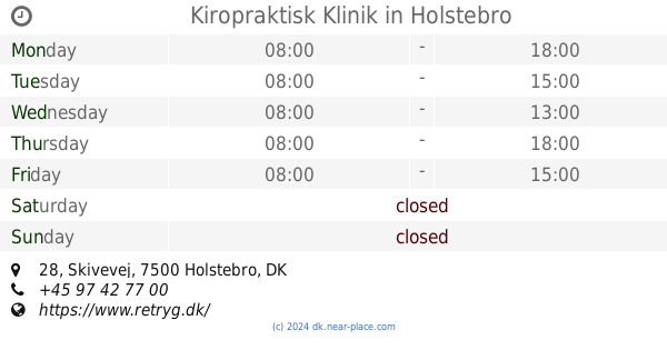
Kiropraktisk Klinik
Skivevej 28, Holstebro
Health
read more
12.685 km
Psykolog Christian Lyngby Blaabjerg
Stationsvej 15, 1., Holstebro
Health
read more
12.977 km
Multihuset
Sportsvej 10, Holstebro
Health
read more
12.989 km
Frishta M-Hasan
Lægårdvej 14 A, Holstebro
Health
read more
13.392 km
Holstebro Svømme Club
Jeppe Schous Gade 14, Holstebro
Health
read more
13.419 km
Nordisk Krisekorps
Vestergade 16, Holstebro
Health
read more
13.472 km
Siam Tradition Original Thai Massage
Østergade 5, Holstebro
Health
read more
13.49 km
Memira
Østergade 6, Holstebro
Health
read more
13.508 km
Holstebro Øjenklinik I/S
Østergade 10, Holstebro
Health
read more
13.768 km
Clinikken
Kimsvej 18, Holstebro
Health
read more
14.655 km
Vestjysk Infektionshygiejne (Vih) Ian P. Gottlieb
Ranunkelvej 10, Holstebro
Health
read more
📑
all categories
Accounting
Administrative area level 1
Administrative area level 2
Airport
Amusement park
Aquarium
Art gallery
Atm
Bakery
Bank
Bar
Beauty salon
Bicycle store
Book store
Bowling alley
Bus station
Cafe
Campground
Car dealer
Car rental
Car repair
Car wash
Casino
Cemetery
Church
City hall
Clothing store
Colloquial area
Convenience store
Country
Courthouse
Dentist
Department store
Doctor
Electrician
Electronics store
Embassy
Finance
Fire station
Florist
Food
Funeral home
Furniture store
Gas station
General contractor
Grocery or supermarket
Gym
Hair care
Hardware store
Health
Hindu Temple
Home goods store
Hospital
Insurance agency
Jewelry store
Laundry
Lawyer
Library
Light rail station
Liquor store
Local government office
Locality
Locksmith
Lodging
Meal delivery
Meal takeaway
Mosque
Movie rental
Movie theater
Moving company
Museum
Natural feature
Neighborhood
Night club
Painter
Park
Parking
Pet store
Pharmacy
Physiotherapist
Place of worship
Plumber
Point of interest
Police
Political
Post office
Premise
Real estate agency
Restaurant
Roofing contractor
Route
Rv park, camping
School
Shoe store
Shopping mall
Spa
Stadium
Storage
Store
Subpremise
Subway station
Supermarket
Synagogue
Taxi stand
Train station
Transit station
Travel agency
University
Veterinary care
Zoo
sublocality level 1
sublocality level 2
↑