Cafe nearby SportsCaféen
Denmark
Cafe nearby SportsCaféen
SportsCaféen
Stadion Alle 2 B, Ikast Dänemark
contacts phone
:
+45
Latitude:
56.1446638
, Longitude:
9.1446614
read more
nearest Cafe
668 m
Olivers Kaffevogn
Nørregade 7, Ikast
Cafe
read more
8.949 km
Golfcafeen Herning
Golfvej 24, Herning
Cafe
read more
9.043 km
Coffee By Karma
Merkurvej 1A, St 1, Herning
Cafe
read more
9.074 km
CIRKEL CAFÉ
Merkurvej 36, Herning
Cafe
read more
9.148 km
Karma herningCentret
Herning
Cafe
read more
9.148 km
Karma herningCentret
Merkurvej 1 D st. 104, Herning
Cafe
read more
9.205 km
Cafe Fry
Merkurvej 39, Herning
Cafe
read more
9.639 km
Åbenkirke - Herning
Olufsgade 10, Herning
Cafe
read more
9.639 km
Åbenkirke
Olufsgade 10, Herning
Cafe
read more
9.936 km
Fynsgade 28
Fynsgade 28, Herning
Cafe
read more
10.25 km
Bohème Vin
Østergade 29, Herning
Cafe
read more
10.267 km
Aroma
Fonnesbechsgade 14, Herning
Cafe
read more
10.289 km
No.25
Østergade 25, Herning
Cafe
read more
10.322 km
Cafe Cosy
Østergade 24, Herning
Cafe
read more
10.379 km
Café Pitstop
Nørregade 4, Herning
Cafe
read more
10.576 km
Angelina's
Bredgade 4 B, Herning
Cafe
read more
10.6 km
Pause Cafe A/S
Bredgade 5D, Herning
Cafe
read more
10.883 km
Cafe Poulsen - Cafe, Restaurant & Vinbar
Bredgade 38, Herning
Cafe
read more
10.932 km
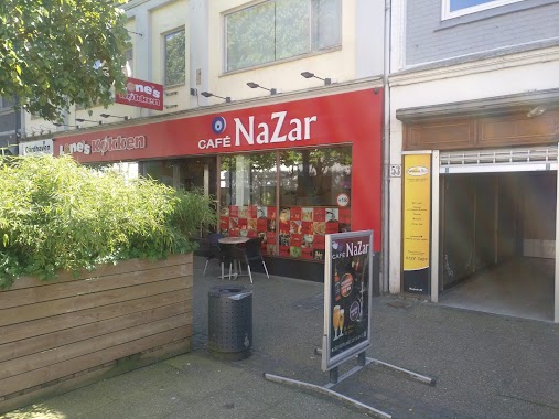
The courtyard - Café Nazar
Bredgade 51, Herning
Cafe
read more
10.987 km
Sham Vandpibe Cafe
Bredgade 59A, Herning
Cafe
read more
11.31 km
Dit Lokale Køkken
Fruehøjvej 44, Herning
Cafe
read more
11.469 km
Overfor Det Store Kastanjetræ
Gl Landevej 160, Herning
Cafe
read more
25.046 km
Ristorante Pizzeria Roma
Drewsensvej 1A, Silkeborg
Cafe
read more
25.075 km
Café Tværgade
Skoletorvet 6C, Silkeborg
Cafe
read more
25.076 km
Danseglad ApS
Nygade 18 B, Silkeborg
Cafe
read more
📑
all categories
Accounting
Administrative area level 1
Administrative area level 2
Airport
Amusement park
Aquarium
Art gallery
Atm
Bakery
Bank
Bar
Beauty salon
Bicycle store
Book store
Bowling alley
Bus station
Cafe
Campground
Car dealer
Car rental
Car repair
Car wash
Casino
Cemetery
Church
City hall
Clothing store
Colloquial area
Convenience store
Country
Courthouse
Dentist
Department store
Doctor
Electrician
Electronics store
Embassy
Finance
Fire station
Florist
Food
Funeral home
Furniture store
Gas station
General contractor
Grocery or supermarket
Gym
Hair care
Hardware store
Health
Hindu Temple
Home goods store
Hospital
Insurance agency
Jewelry store
Laundry
Lawyer
Library
Light rail station
Liquor store
Local government office
Locality
Locksmith
Lodging
Meal delivery
Meal takeaway
Mosque
Movie rental
Movie theater
Moving company
Museum
Natural feature
Neighborhood
Night club
Painter
Park
Parking
Pet store
Pharmacy
Physiotherapist
Place of worship
Plumber
Point of interest
Police
Political
Post office
Premise
Real estate agency
Restaurant
Roofing contractor
Route
Rv park, camping
School
Shoe store
Shopping mall
Spa
Stadium
Storage
Store
Subpremise
Subway station
Supermarket
Synagogue
Taxi stand
Train station
Transit station
Travel agency
University
Veterinary care
Zoo
sublocality level 1
sublocality level 2
↑