Supermarket nearby siuntinys nx
Denmark
Supermarket nearby siuntinys nx
siuntinys nx
10, Stokagervej, 8240, Risskov, DK Dinamarca
contacts phone
:
+45
Latitude:
56.206542
, Longitude:
10.2283059
larger map & directions
read more
nearest Supermarket
785 m
Netto
Korshøjen 1, Risskov
Supermarket
read more
1.054 km
MENY Risskov
Tornebakken 1, Risskov
Supermarket
read more
1.059 km
Meny oksemørbrad
Tornebakken 01, Risskov
Supermarket
read more
1.165 km
LIDL
Ravnsøvej 60, Risskov
Supermarket
read more
1.402 km
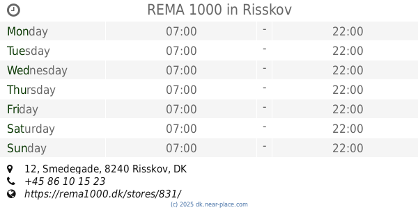
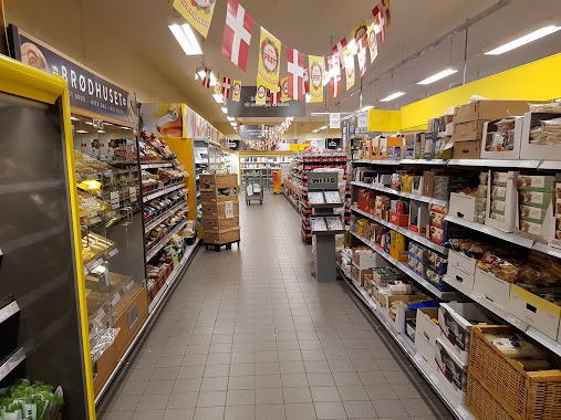
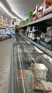
REMA 1000
Smedegade 12, Risskov
Supermarket
read more
1.657 km
Vejlby Kiosk v/Peter Bramstrup
Tranekærparken 3, Risskov
Supermarket
read more
1.759 km
Fakta Q
Nordre Strandvej 19, Risskov
Supermarket
read more
2.019 km
Алди
Åmarksvej 22, Egå
Supermarket
read more
2.044 km
REMA 1000
A, Nordre Strandvej 127, Risskov
Supermarket
read more
2.058 km
Netto
Frijsenborgvej 5, Risskov
Supermarket
read more
2.084 km
Netto Ndr. Strandvej Risskov
Nordre Strandvej 127B, Risskov
Supermarket
read more
2.084 km
Netto
Nordre Strandvej 127B, Risskov
Supermarket
read more
2.086 km
føtex Egå
Brobjerg Parkvej 2 - 8, Egå
Supermarket
read more
2.108 km
Kvickly Vericentret
Frijsenborgvej 5, Risskov
Supermarket
read more
2.174 km
Fakta
Veri Center, Frijsenborgvej 5, Risskov
Supermarket
read more
2.557 km
Netto
Lyshøjen 1, Lystrup
Supermarket
read more
2.557 km
Netto Lystrup
Lyshøjen 1, Lystrup
Supermarket
read more
2.567 km
føtex Skejby
Skejby Centret, Skelagervej 1-9, Aarhus N
Supermarket
read more
2.649 km
Aldi Marked
Sønderskovvej 4, Lystrup
Supermarket
read more
2.651 km
ALDI Lystrup
Sønderskovvej 4, Lystrup
Supermarket
read more
2.89 km
Bilka Outlet
Graham Bells Vej 22, Aarhus N
Supermarket
read more
2.904 km
LokalBrugsen Vorrevangen
Vorregårds Alle 96, Århus N
Supermarket
read more
2.904 km
LokalBrugsen Vorrevangen
Vorregårds Alle 96, Aarhus N
Supermarket
read more
2.918 km
Lidl
Skejbyvej 499, Aarhus N
Supermarket
read more
2.918 km
Lidl Skejby
Skejbyvej 499, Aarhus N
Supermarket
read more
📑
all categories
Accounting
Administrative area level 1
Administrative area level 2
Airport
Amusement park
Aquarium
Art gallery
Atm
Bakery
Bank
Bar
Beauty salon
Bicycle store
Book store
Bowling alley
Bus station
Cafe
Campground
Car dealer
Car rental
Car repair
Car wash
Casino
Cemetery
Church
City hall
Clothing store
Colloquial area
Convenience store
Country
Courthouse
Dentist
Department store
Doctor
Electrician
Electronics store
Embassy
Finance
Fire station
Florist
Food
Funeral home
Furniture store
Gas station
General contractor
Grocery or supermarket
Gym
Hair care
Hardware store
Health
Hindu Temple
Home goods store
Hospital
Insurance agency
Jewelry store
Laundry
Lawyer
Library
Light rail station
Liquor store
Local government office
Locality
Locksmith
Lodging
Meal delivery
Meal takeaway
Mosque
Movie rental
Movie theater
Moving company
Museum
Natural feature
Neighborhood
Night club
Painter
Park
Parking
Pet store
Pharmacy
Physiotherapist
Place of worship
Plumber
Point of interest
Police
Political
Post office
Premise
Real estate agency
Restaurant
Roofing contractor
Route
Rv park, camping
School
Shoe store
Shopping mall
Spa
Stadium
Storage
Store
Subpremise
Subway station
Supermarket
Synagogue
Taxi stand
Train station
Transit station
Travel agency
University
Veterinary care
Zoo
sublocality level 1
sublocality level 2
↑