School nearby Dybsø Naturskole
Coronavirus disease (COVID-19) Situation
confirmed cases
3183756
deaths
8814
Denmark
School nearby Dybsø Naturskole
Dybsø Naturskole
66, Dybsøvej, 4700, Næstved, DK Dinamarca
contacts phone
:
+45 55 70 01 53
website:
www.naestvednatur.dk
Latitude:
55.1688613
, Longitude:
11.7665295
larger map & directions
read more
nearest School
161 m
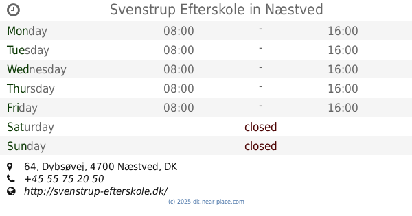
Svenstrup Efterskole
Dybsøvej 64, Næstved
School
read more
3.845 km
Eventyrgården
Dyssegårdsvej 6, Næstved
School
read more
3.956 km
Sjølundsskolen
4700, Appenæs Bygade 1, Næstved
School
read more
4.021 km
Tulipanhuset
Troensevej 27, Næstved
School
read more
4.044 km
Børnehuset Sjælland
Troensevej 10, Næstved
School
read more
4.072 km
Ucsj
Parkvej 190, Næstved
School
read more
4.205 km
VUC Storstrøm Næstved
Birkebjerg Alle 1, Næstved
School
read more
4.208 km
Knowledge Center For Special Needs In Næstved
Birkebjerg Alle 3, Næstved
School
read more
4.237 km
SOSU Zealand Næstved
Troensevej 2, Næstved
School
read more
4.283 km
Hollænderhusene
Korinthvej 12, Næstved
School
read more
4.603 km
Børnehuset ved Volden
Parkvej 144 B, Næstved
School
read more
4.613 km
Kobberbakkeskolen afd. Rønnebæk
Englebjergvej 12, Næstved
School
read more
4.624 km
Svalen Børnehaven
Åderupvej 135, Næstved
School
read more
4.637 km
Børnehuset ved Diget
Parkvej 142, Næstved
School
read more
4.712 km
Kobberbakkeskolen afd. Uglebro & Sfo Pingvinen
Nygårdsvej 110, Næstved
School
read more
4.924 km
Friskolen Af 2008
Morsøvej 6, Næstved
School
read more
5.594 km
Næstved Gymnasium og HF
Nygårdsvej 43, Næstved
School
read more
5.633 km
Kobberbakkeskolen afd. Sjølund
Nygårdsvej 62, Næstved
School
read more
6.41 km
Teknisk Gymnasium Næstvved
Jagtvej 2D, Næstved
School
read more
6.65 km
Musikskole
Skellet 24, Næstved
School
read more
7.405 km
Grønnebakken Nina
Kildemarksvej 130, Næstved
School
read more
7.409 km
Børnehaven Mariehuset
Marievej 2, Næstved
School
read more
8.609 km
Herlufsholm Skole
Herlufsholm Alle 170, Næstved
School
read more
9.329 km
Dekra
Næstved Storcenter, Næstved
School
read more
16.307 km
Børnehuset Troldehaven
Sankt Clemensvej 32, Vordingborg
School
read more
📑
all categories
Accounting
Administrative area level 1
Administrative area level 2
Airport
Amusement park
Aquarium
Art gallery
Atm
Bakery
Bank
Bar
Beauty salon
Bicycle store
Book store
Bowling alley
Bus station
Cafe
Campground
Car dealer
Car rental
Car repair
Car wash
Casino
Cemetery
Church
City hall
Clothing store
Colloquial area
Convenience store
Country
Courthouse
Dentist
Department store
Doctor
Electrician
Electronics store
Embassy
Finance
Fire station
Florist
Food
Funeral home
Furniture store
Gas station
General contractor
Grocery or supermarket
Gym
Hair care
Hardware store
Health
Hindu Temple
Home goods store
Hospital
Insurance agency
Jewelry store
Laundry
Lawyer
Library
Light rail station
Liquor store
Local government office
Locality
Locksmith
Lodging
Meal delivery
Meal takeaway
Mosque
Movie rental
Movie theater
Moving company
Museum
Natural feature
Neighborhood
Night club
Painter
Park
Parking
Pet store
Pharmacy
Physiotherapist
Place of worship
Plumber
Point of interest
Police
Political
Post office
Premise
Real estate agency
Restaurant
Roofing contractor
Route
Rv park, camping
School
Shoe store
Shopping mall
Spa
Stadium
Storage
Store
Subpremise
Subway station
Supermarket
Synagogue
Taxi stand
Train station
Transit station
Travel agency
University
Veterinary care
Zoo
sublocality level 1
sublocality level 2
↑